Mount Kisokoma (Kiso-komagatake, 木曽駒ケ岳) is a 2,956m high mountain in  Kiso DistrictNagano Prefecture, Japan. The mountain belongs to the "Kiso mountains", also called "Central Alps". Hikers can take the Komagatake Ropeway and it takes you from the base of the mountain up the Senjōjiki Col, a large cirque, located at 2,650m. Before you take Komagatake Ropeway, you need to catch a bus form Suganodai Bus center or Komagane Ekimae (JR Komagane Sta.) Shirabidaira Station of the ropeway.


Access:
JR Komagane Station (駒ヶ根駅) 
Komgatatake Ropeway: https://www.chuo-alps.com/lang/en/
Access: https://www.chuo-alps.com/lang/en/getting-here/getting-onoff-the-shuttle-bus-and-paying-the-fare/
https://www.chuo-alps.com/lang/en/getting-here/getting-onoff-the-shuttle-bus-and-paying-the-fare/


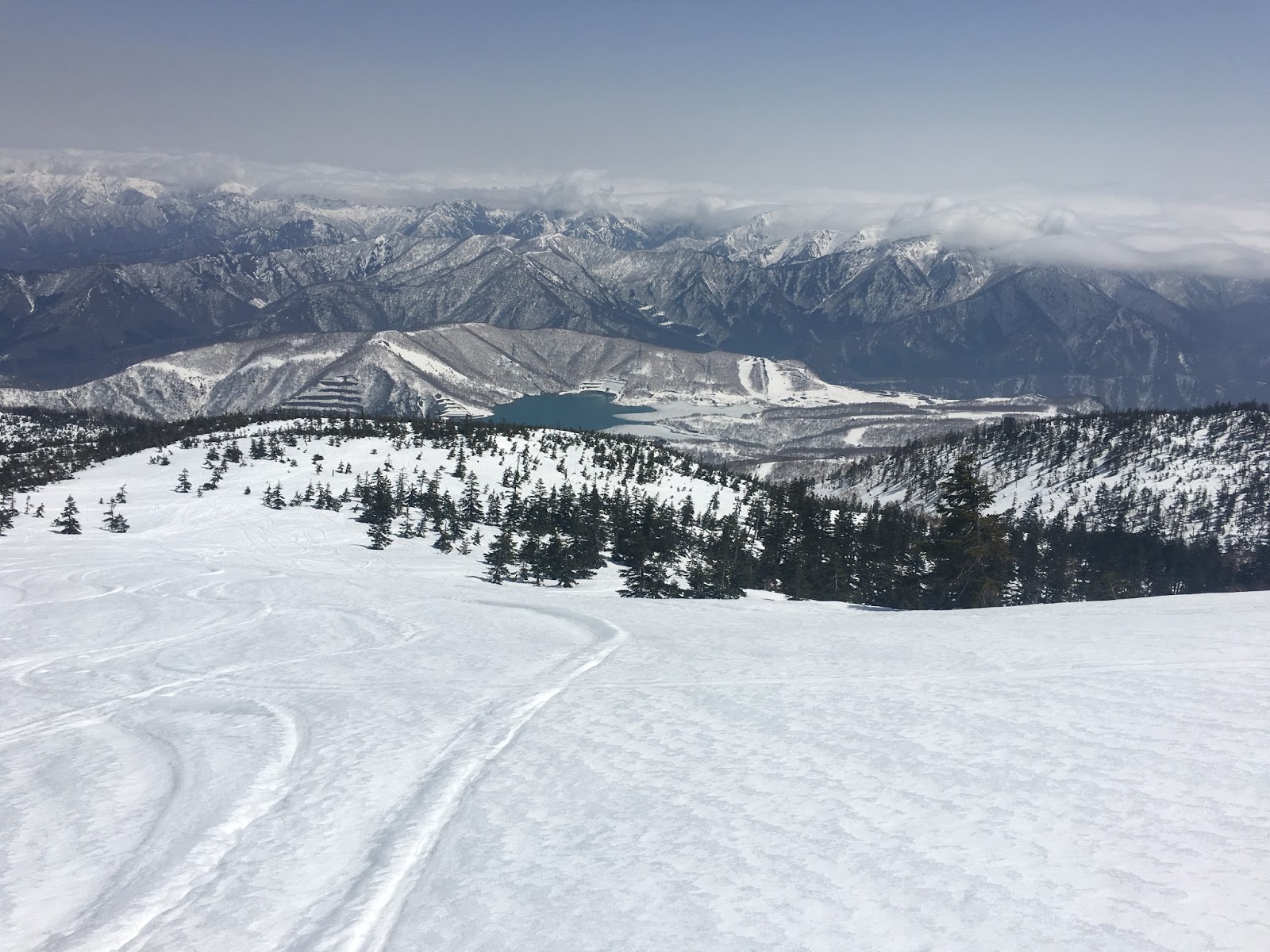
From the top of the ropeway, with looking up the Senjōjiki Col, a large cirque at 2,650 m. We have already been above clouds.


Hikers and tourists use the same trail for 15 min. Then trail starts elevating towards north-west. Until reaching to the col at 2,858m, it made hikers hike up very slowly on the narrow and steep trail due to crowded by too many hikers of all ages.

We stood on the top of three mountains, Mt. Kisokoma, Mt. Naka, and Mt. Houken. Our GPS track of today's hiking is as follows.


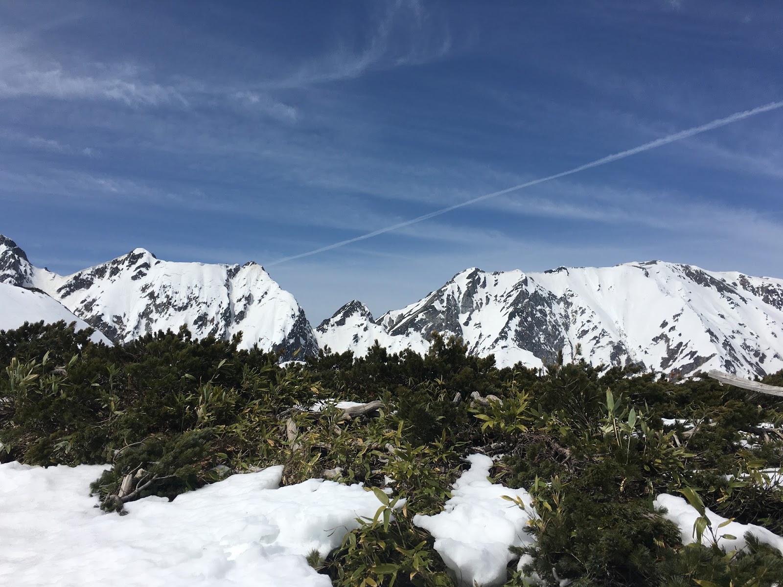
A panorama view from the col at 2,858m.

There was a shrine at the top of Mt. Kisokoma.

A panorama view from the Nougaike (Nou pond) at 2,655m.

Amazing view from Komakai-no-ike (Komakai pond) at 2,712m. Water flow from the snowy gorge was very cool.

Note that it's very famous sightseeng place and there a lot of tourists, however, the mountains are on the 3,000m class. You need to prepare the weather changes and altitude anoxia.

See also:
https://japanhike.wordpress.com/2008/03/29/mt-kiso-komagatake/
https://www.chuo-alps.com/lang/en/experience-the-central-alps-senjojiki-cirque/senjojiki-cirque-hiking-trail/


Mount Tsubakuro (Tsubakuro-dake, 燕岳) is a 2,763 metre high mountain in Nagano Prefecture, Japan.


When we arrived at Nakabusa-onsen (Nakabusa spa, 中房温泉), thousand number of stars blighted whole over the sky!!! There was the Milky Way!!! Unfortunately, we don't have a skill to take a picture of stars and the Milky Way. It's a simple surprise that it can be seen the Milky Way from Japan, where is covered by the city lights in the night. It was because Nakabusa-onsen is located in the mountain area and far away from the nearest city.

Next morning, we started into the mountain trail at 7 o'clock, due to over slept... We knew it takes from 8 to 9 hours to make a round trip. Therefore, we thought that we should have to wake up at 5 and start 6 o'clock at least. Emmmm.... but, we seemed to be tired...

Anyway, we departed the start point of a trail up to a Mt. Tsubakuro,1462m high, Nakabusa-onsen.


Whole picture of a map and elevation graph are follows:


Approximately 2 km of walk, we arrived at one of the rest stations, Fujimi-bench, where you can see the Mt. Fuji showing its top from the cloud.


There is a mountain lodge named Kassen-goya on the middle of the trail.


Kassen-goya (Kassen Hut) is very famous for serving a cut of water melon. They sell the 1/8 cut of water melon by 700 yen. We ate this water melon on the back way to Nakabou-onsen after we reached the top of Mt. Tsubakuro, but usually, hikers eat this water melon on their way to the top for the hydration.


After leaving Kassen-goya (Kassen Hut), the trail became steep. Soon after that, Mt. Yari (Yarigatake in Japanese) suddenly appeared on our left. Mt. Yari is one of the famous and popular mountain in Japan, maybe the second famous followed by Mt. Fuji.


At 2712m, very close to the summit of Mt. Tsubakuro, there is a hut, Enzanso (Enzan Hut, 燕山荘). We haven't know that there is a dolphin like rock called "dolphin rock" around the hut


We can leave our main backpacks at the front of the hut, and we attack the summit with minimum equipments.


We pass the glass like rock called "megane (a glass in Japanese) iwa".


After 4 and half hours departed from the bottom of the trail, we reached the top of Mt. Tsubakuro. The small rock in the picture is the mark of the summit.


Ridge lines were very beautiful.


In the highland area, clustered Komakusa (English name: Dicentra peregrina) were fully blooming.


Total time of this trekking was just 8 hours and it's a regulation duration.


Way to the Nakabusa Onsen:
 Nakabusa Onsen (only available in Japanese)


Mt. Sanbon-yaridake (三本槍岳(さんぼんやりだけ)) is a mountain with 1917 m high and places at the boarder of Fukushima and Tochigi Prefectures.


The blue sky welcomed us and it was a very nice trekking day with beautiful trail between mountains.

Walking on the trail with Mt. Chausu-dake (茶臼岳) on our left. Mt. Chausu-dake can be more easily accessed by the Nasu ropeway and walking less than one hour.(see the trail map here)

Nasu ropeway

Nasudake, Nasucho Yumoto, Nasu-gun, Tochigi prefecture, 325-0301, Japan
Nasu ropeway

We passed through the col called Mineno-chaya where is famous for the strong wind. It is always so, the wind around here is very strong and cold. You need to prepare your wear protection against cold.


 After approximately two hours of hiking, we reached to the top of Mt. Sanbon-yaridake.


We dropped by Mt. Asahidake.


After 9:00 am, a number of hikers increased, so it's better to start at early morning.

Around Mt. Chausudake, you can hear the sound very similar to the jet airplane flying just over you. It's a kind of small explosion sound, because Mt. Chausudake is a volcanic mountain.


Kakinotane(柿の種)is a common Japanese snack. It tastes like a senbei (soy source flavored rice crisps), but more small. It is said that the figure is like a seed of a fruits. There are some products with different tast and the most common one is with peanuts. 


"Guinomi"(ぐい呑) or "Ochoko"(おちょこ) is a generic term for the flask and cups used to serve Japanese sake. Ochoko in the shape of Mt. Fuji is good for a souvenir from Japan.

杯 招福杯 おちょこ 富士山 日本製 金透き 65ml


Mt. Karamats (唐松岳)
Mt. Karamatsu (Karamatsu-dake in Japanese) is in the Japanese Alps, and 2,696m high at its peak located in Nagano Prefecture. You can access to the mountain via Happo-one snow resort, which is one of the famous snow resort in Hakuba village.


https://ja.wikipedia.org/wiki/%E5%94%90%E6%9D%BE%E5%B2%B3

Hakuba Happo-one
Hakuba Alpine Resort

Hiking information
http://www.yamakei-online.com/yk_map/?latlon=36.69142661176844,137.78474669603756&zoom=14 

Trail is still covered by a few meters of snow, so you certainly need to prepare the trekking gears for winter season such as axes and climbing irons. Climbing is started from the top of the Hakuba Happo-one snow resort. At this time, we didn't reach to the top of Mt. Karamatsu, because of the time shortage.


Japan Meteorological Agency have announced that the El Niño event, which had persisted since boreal summer 2014, is likely to have ended in spring 2016. 2015-2016 winter season in Japan have been affected a lot by this El Niño event.

Shorter snow season, less snow overall, late opening and early closing at Ski resorts... But sometimes a contradiction happens such like strong snowstorms. It seems more difficult to predict and avoid an avalanche for skiers, snowboarders, and mountain climbers.


Many of the ski areas in Niigata Pref. still open in April with a dozen feet of snow on the ground in a usual season and have a snow-park with huge size of kickers and jib items, but not in this season. There remains a few ski resorts that still open in this condition, Kagura was one of them. Kagura ski resort is one of the largest combined ski resort in Niigata Pref.

They have brought in the gate system for the backcountry skiers and snowboarders from the beginning of 2015-2016 season. The users must show a document written down everything about their plans and routes to the patrol. Then you have to check your avalanche beacon functioning well.

After checking everything was OK, well prepared, then you can come into the gate, and start hiking.

Also, you need to have a phone call to the patrol office after you get back safely to the base. It seems pretty much for an expert, however, it is very good for a beginner to prepare their stuff well.


Kagura Mitsumata Ski Resrort
Address:  Mitsumata, Yuzawa, Minamiuonuma District, Niigata Prefecture, 949-6211, Japan
http://www.princehotels.com/en/ski/mtnaeba/index.html
http://www.snowjapan.com/japan-ski-resorts/niigata/yuzawa/kagura
Open Until: End of May in usual

Yuzawa Town
http://www.e-yuzawa.gr.jp/english/


 Snow report on 2th March, 2016 from Okutadami-Maruyama Snow Resort,  Niigata Japan. The resort is closed during midwinter and re-opend in the middle of March.

 This 32.4km-long-drippy-rock-surface-tunnel leading to Okutadami-Maruyama snow resort is called "Silver Line". The Okutadami dam is a hydroelectric power generation purpose dam and was built in 1960s. The 32.4 km-long tunnel was for the purpose of construction work. The snow resort is located in the upper part of the dam.

 The resort takes advantages of large amount of snowfall, it usually has a big half-pipe and over 10m kickers. Due to record-breaking warm winter, there are no half-pipe in this spring season.

 The depth of snow is only 3m though it is over 5m on an average year.