Showing posts with label slider. Show all posts

Mt. Mizugaki (瑞牆山) is the 2,230m high mountain belonging to the Okuchichibu Mountainous Region which places the Yamanashi Pref. and Tokyo. The peak features rocky formations and very good views of the surrounding mountainous such as South alps mountains and Mt. Fuji.
 

Mt Mizugaki is a famous mountain for the entry level hikers, kids, and students. The main route from Mizugaki-sanso is thus sometimes in very cloudy situation such that there is no place to park a car. However, there are some variation route for treking combined with Mt. Kinpu etc.


We have chosen a round tour route from Mizugaki-yama nature center.


The trail starts from the end of forest road for cars. 


Very quiet forest trail, stream of water, beautiful falls, Granite rocks...


From the top of Mt. Mizugaki, we could see the landscape of Mt. Fuji and South alps mountains.


瑞牆山
https://ja.wikipedia.org/wiki/%E7%91%9E%E7%89%86%E5%B1%B1


Mt. CHOU (蝶ヶ岳:Chou-ga-take) is the Japanese mountain with 2,677m high peak. The climbing was started from Mitsumata (三股登山口) at 1,350m close to Azumino city.


A suspension bridge near the start point.


GODZILLA TREE


A wild berry..


There is a hut on the top of Mt. CHOU and you can stay here.


Mt. YARI is one of the 100 Famous Japanese Mountains with 3,180 m high peak.


Panorama view from the top.


Monkeys!


Our tracks.


 Myoko area, Niigata prefecture in Japan, have been of interest for skiers and snowboarders around the world. The Myoko area is an area surrounding around the Mt. Myoko and have seven snow resorts. The Myoko area is famous for winter sports because of extraordinary heavy snowfall such like 50-70cm in a night. The area places very close to the Japanese sea, and snow contains sea water a lot. Therefore, snow is somehow heavy compared to the other ski resorts that is placed in an inland region.


Mt. Myoko from Imori pond (Imori-ike, いもり池) in April.

 The summer time in Myoko area also very exciting place for trekking, hiking, camping and staying. In autumn, a lot of tourists visit here to see the autumn leaves, but there are not so much visitors in the summer so it is very quiet. Comparing to the Hakuba area, which is very famous resort village, Myoko area is a simple, natural, rustic, not so much "resort" village. That's why we love this place.

 We went to climb Mt. Hiuchi, which is placed north-west from Mt. Myoko. Mt. Hiuchi is a 2,462m high mountain in Niigata prefecture in Japan.

Mt. Hiuchi https://en.wikipedia.org/wiki/Mount_Hiuchi
Mt/ Myoko https://en.wikipedia.org/wiki/Mount_My%C5%8Dk%C5%8D


 Last year, we climbed up the Mt. Myoko from Akakura-kanko ski resort. Mt. Myoko and Mt. Hiuchi are neighboring mountains each other. There are some routes to climb up the Mt. Hiuchi. We used the route starting from Sasagamine Plateau this time. At the Sasagamine Plateau, there are two large parking lot for the campers and hikers near the Sasagamine camping site.

 The trail is well prepared and boardwalk continues at the middle of the trail.


 At the forth part of the trail, there are twelve curves (Juuni-magari, 十二曲り) to climb a steep slope.


 At the middle of the trail, we could see Mt. Yake, Mt. Kage-hiuchi, and Mt. Hiuchi, from left in the picture. Mt. Yake is an active volcano and strictly exhibited to the entrance.


At 2,100m, there are the muskeg area near the Koyaike Hut.


Fun walking for just 4 hours, we arrived at the top of Mt. Hiuchi, 2,462m!!


Mt. Yake can be seen very closely from the top. It's an active volcano and the surface around the mountain top seems to be covered by the ash. A week after we visited, there was a news that tells Mt. Yake's activity is getting intense and a exhaust port increased to three!


The trail to Mt. Myoko from Mt. Hiuchi.


Myoko http://www.myoko.tv/english/index.html
Mt. Hiuchi https://en.wikipedia.org/wiki/Mount_Hiuchi
Mt/ Myoko https://en.wikipedia.org/wiki/Mount_My%C5%8Dk%C5%8D
Sasagamine camp site: https://www.tripadvisor.jp/Hotel_Review-g1021352-d7053778-Reviews-Sasagamine_Camp_Site-Myoko_Niigata_Prefecture_Chubu.html
Koya-ike Hut http://www.suginosawa.com/koyaike_yoyaku/


Japan Meteorological Agency have announced that the El Niño event, which had persisted since boreal summer 2014, is likely to have ended in spring 2016. 2015-2016 winter season in Japan have been affected a lot by this El Niño event.

Shorter snow season, less snow overall, late opening and early closing at Ski resorts... But sometimes a contradiction happens such like strong snowstorms. It seems more difficult to predict and avoid an avalanche for skiers, snowboarders, and mountain climbers.


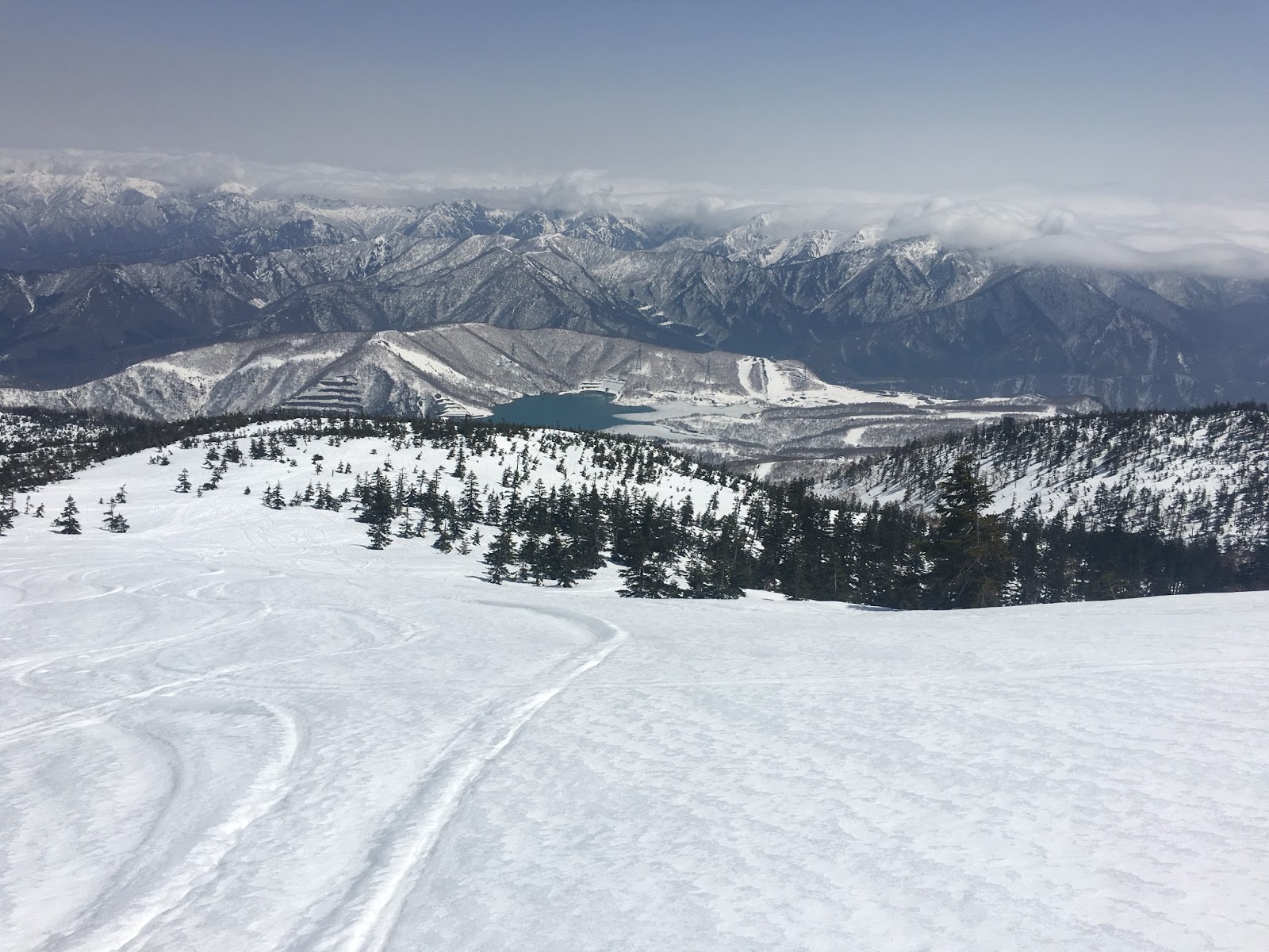
Many of the ski areas in Niigata Pref. still open in April with a dozen feet of snow on the ground in a usual season and have a snow-park with huge size of kickers and jib items, but not in this season. There remains a few ski resorts that still open in this condition, Kagura was one of them. Kagura ski resort is one of the largest combined ski resort in Niigata Pref.

They have brought in the gate system for the backcountry skiers and snowboarders from the beginning of 2015-2016 season. The users must show a document written down everything about their plans and routes to the patrol. Then you have to check your avalanche beacon functioning well.

After checking everything was OK, well prepared, then you can come into the gate, and start hiking.

Also, you need to have a phone call to the patrol office after you get back safely to the base. It seems pretty much for an expert, however, it is very good for a beginner to prepare their stuff well.


Kagura Mitsumata Ski Resrort
Address:  Mitsumata, Yuzawa, Minamiuonuma District, Niigata Prefecture, 949-6211, Japan
http://www.princehotels.com/en/ski/mtnaeba/index.html
http://www.snowjapan.com/japan-ski-resorts/niigata/yuzawa/kagura
Open Until: End of May in usual

Yuzawa Town
http://www.e-yuzawa.gr.jp/english/


You may have a impression about nuclear disaster at Fukushima power plant in March 2011. In fact, there are still a lot of people who cannot get back to their home due to the high radiation level, however, Fukushima prefecture is horizontally long shaped prefecture and there are few affects in the mountain side. There are many snowy mountains inland.

Mt. Aizu Komagatake (会津駒ケ岳)
https://en.wikipedia.org/wiki/Mount_Aizu-Komagatake
http://www.snowjapan.com/japan-ski-resorts/town/hinoemata


It will take 6-8 hours to hike up by snowshoes.


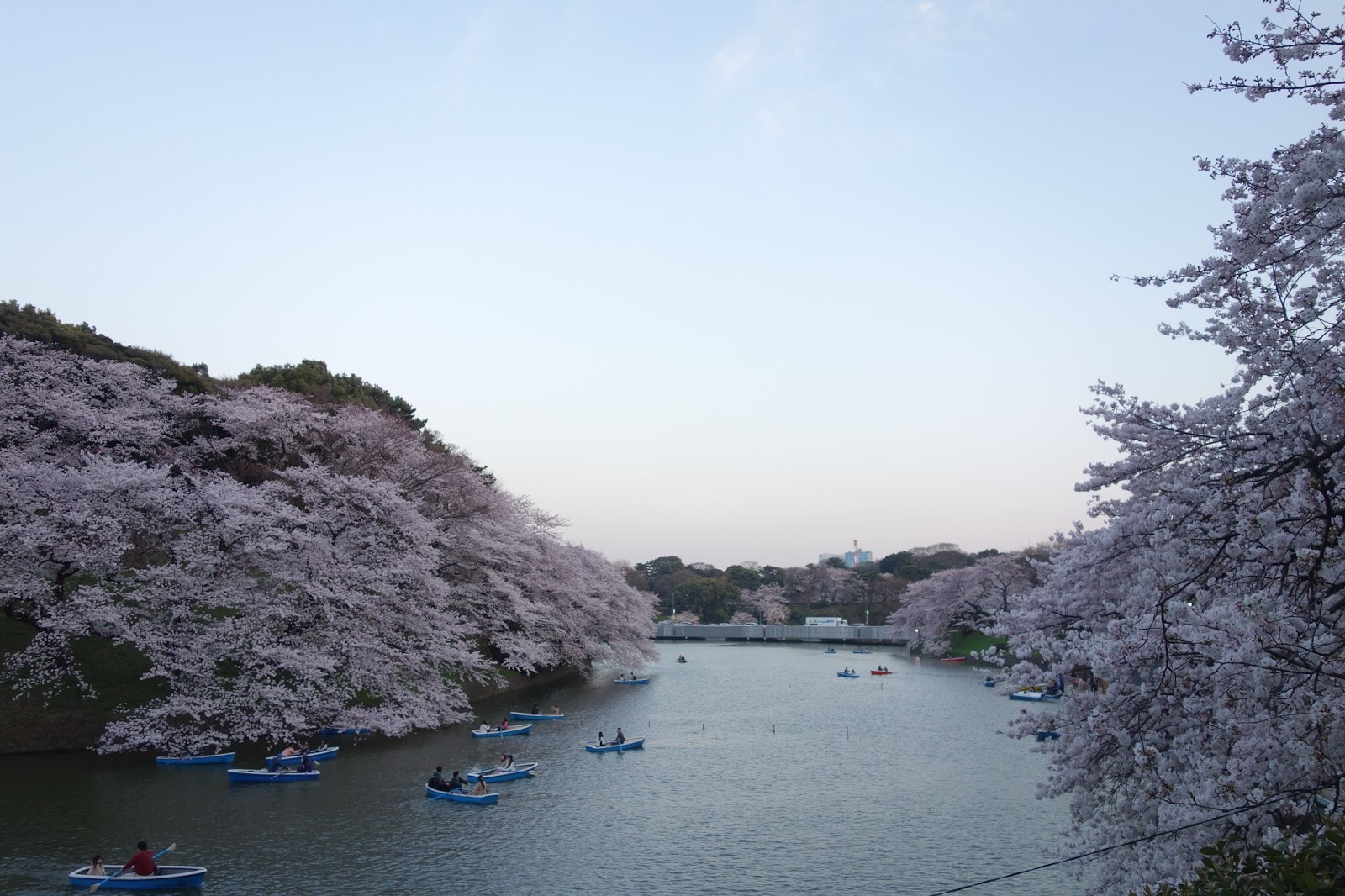
Spring is the time for a custom of cherry blossom viewing, which involves passing through or eating or drinking under cherry blossom trees. Cherry blossom start blooming from the south Japan in the end of March and move toward the north Japan, and finally finish at Hokkaido in the start of May.

Generally, in Tokyo or Osaka, in the middle of main island, it can be seen from the end of March to the start of April. The cherry blossom in full bloom is in a moment, say only one week or so.

In this year, we enjoyed cherry blossom viewing (Hanami in Japanese) around Tokyo.

In Chidorigafuchi:


In Akasaka:


At the river side of the Meguro river:


 Visit Japan in the end of the March and you may be able to enjoy them.


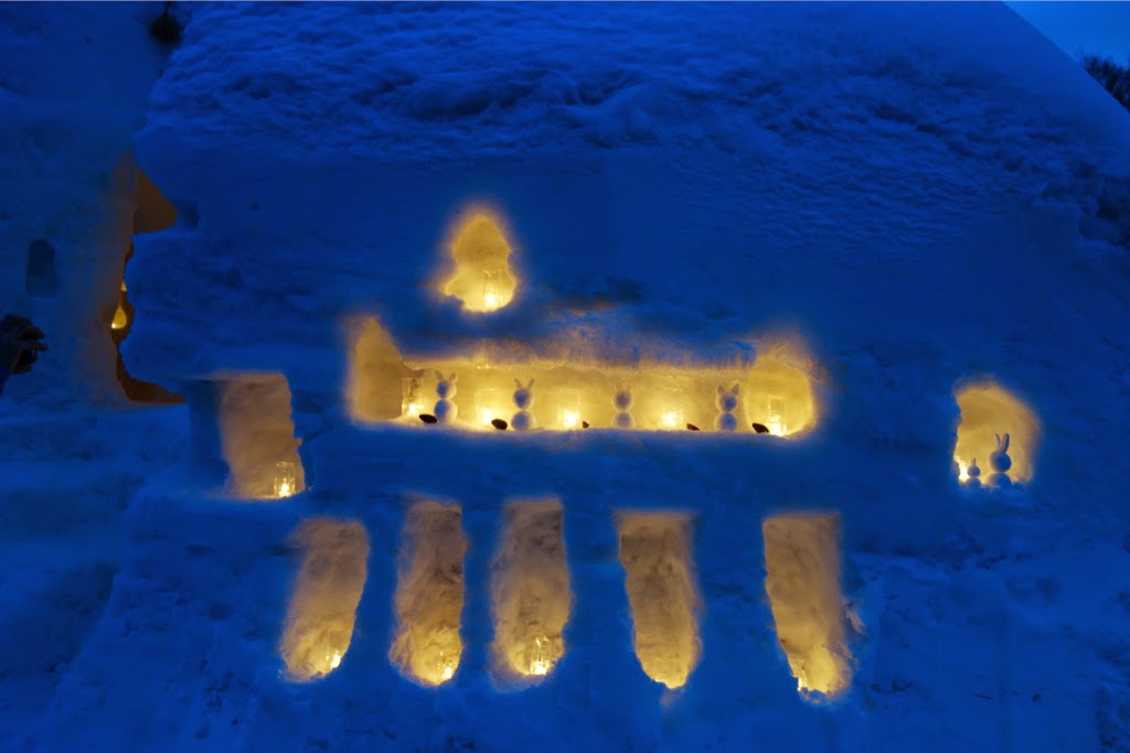
Though I don't know the correct English, Yukihatago-Lightning is the festival of lighted reproduced-tavern built by the snow.

Event page
Yukihatago Facebook event page

A picture is worth a thousand words... This year is 10th anniversary of this festival. Gassan-Shizu onsen flourished as village of Japanese-inn for practitioners of Shindo who headed to Mt. Gassan. Now, the tavern in period building were reproduced by snow.


A shrine.

Snow rabbit.