If you come to Japan and plan to enjoy trekking here, please use following information as a reference. There are some equipments and goods available in Japan, check and enjoy to use them!


Wear and Equipments

Montbell is founded in 1975 in Japan by a Japanese man and is today one of the Japanese largest suppliers of outdoor equipment. There are large number of products for various kinds of activities developing by Montbell itself.

http://en.montbell.jp/products/


in Tokyo

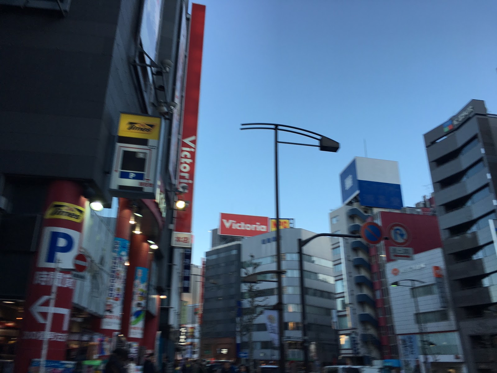
In Tokyo, there are a lot of sports equipment shops. Especially in around Ochanomizu station, mass retailer of various sports shops for ski, snowboard, surfing, cycling, golf, running, climbing, trekking...etc, open shops.  Following lists display some of them around Shinjuku, Shibuya, Ikebukuro, and Ochanomizu stations.

In addition, almost all of the world's famous outdoor brands have stores in Shibuya, for example, Nike, Adiddas, Burton, Patagonia, Millet, Hoglofs, The North Face, Oarkley, Mammut, Columbia, GREGORY...etc..


Sport nutrition foods


 Weider in Jelly (ウイダーinゼリー ) is the most famous jelly foods in Japan. You can get them from amazon or even convenience store everywhere in Japan.

ウイダーinゼリー (Weider in Jelly) エネルギー マスカット味 180g×6個 ウイダー https://www.amazon.co.jp/dp/B00BAN5XQ2/ref=cm_sw_r_tw_dp_x_HIJ4xbSR1SQBV

ウイダーinゼリー マルチミネラル 180g×6個 ウイダー
https://www.amazon.co.jp/dp/B00TZE7D9S/ref=cm_sw_r_tw_dp_x_CJJ4xb9RAGEC6

ウイダーinゼリー プロテイン ヨーグルト味 180g×6個 ウイダー
https://www.amazon.co.jp/dp/B00I95JY9Q/ref=cm_sw_r_tw_dp_x_XJJ4xbF9RW4E2


山と高原地図(Yama-to-Kougen-Tizu)is the most famous trekking maps and guides in Japane. They are renewed every year, so 2016 versions are available in Japan. You can purchase them from Amazon or the other book store in Japan.


For Mt. Yari and Mt. Hotaka area
山と高原地図 槍ヶ岳・穂高岳 上高地 2015 (登山地図 | マップル)   昭文社 地図 編集部 https://www.amazon.com/dp/439876237X/ref=cm_sw_r_tw_dp_x_zem6xb70BTN2W
 see our trekking log here.

For Yatsugatake Mountains
山と高原地図 八ヶ岳 蓼科・美ヶ原・霧ヶ峰 2015 (登山地図 | マップル)   昭文社 地図 編集部 https://www.amazon.com/dp/4398762329/ref=cm_sw_r_tw_dp_x_Cem6xbBV44988
  see our trekking log here.

For Hakuba area
山と高原地図 白馬岳 2015 (登山地図 | マップル)   昭文社 地図 編集部
https://www.amazon.com/dp/4398762345/ref=cm_sw_r_tw_dp_x_Aem6xb0SQKBF7
  see our trekking log here.

For Myoko area
山と高原地図 妙高・戸隠・雨飾 2016 (登山地図 | マップル)   昭文社 地図 編集部 https://www.amazon.co.jp/dp/4398762787/ref=cm_sw_r_tw_dp_x_7xJ4xbBBW6RQE
  see our trekking log here.

To check the all of the series for Japanese mountains...
Mapple: http://ec.shop.mapple.co.jp/shopbrand/nc10502/


They even produce the digital version of them. Following images are the "山と高原地図.app" for iPhone. They have it for Android version.


Open the App, there are only three menu on the top screen. From top to bottom, "地図を選ぶ" is for selection of the maps, "ルート管理" for personal trekking logs, and "設定" is for the settings.

If you select the top menu "地図を選ぶ" for selection of the maps, it appears the purchased digital maps list as follows. As I mentioned above, the maps are renewed every year and digital versions are also updated. So I re-buy the maps about every 2 years.


Just tap the name of the map, the trail map appears as follows. You can check the trail route and the average course time for mountain hikers.


 The map can be enlarged. There are some typical marks to read the maps. It may OK if you can't read Japanese or Kanji, because this is a map. So, you can imagine what they mean.


For example, the displaying time between ⭕️and⭕️ means a normal (for the averaging pace of trekking) course time between them. House marks means lodge or hut, a drop mark (💧) means a water supply.


The settings are very simple. The most frequently used one is an interval for GPS tracking.
You can choose them from 1min to 10min.


In the snow season, Yuzawa (Niigata Pref. in Japan) area is very famous for hot springs and skiing nouth of Tokyo. Mt. Naeba is placed behind the Kagura ski resort.


Getting to the trail: From Tokyo to Yuzawa, you can use the Joetsu line of the Shinkansen bullet train. In the summer time, you may use the bus from the station to near the ski resort, but it is better to lent a car at the station. You can access to the trail entrance in the middle of the ski resort.

https://www.yamareco.com/modules/yamareco/detail-960415.html

 Start from the parking few hundred meters below the Wada lodge, and heading to the Wada lodge.


You can find Wada lodge and in front of it, there is a ski course. The trail starts here and we walked the right side of the ski course. 


In the winter season, many skiers and snowboarders come here, Mt Kagura, to enjoy backcountry skiing and snowboarding.


By passing through the Mt. Kagura, Mt. Naeba with flat table top appears suddenly.


In the winter, following image is the outlook of Mt. Naeba from almost same place.


The top of the mountain is a plateau looks like it is up in the air.


The mark of Mt. Naeba's top.


We found there is an indicator that tells there is a shrine on the plateau, and we looked for it and found very small one.


Once fog covered the plateau, it becomes very cold but more fantastic scenery and we enjoyed it.


Our traking log can be found at Yamareco site.


https://en.wikipedia.org/wiki/Mount_Naeba


Mt. CHOU (蝶ヶ岳:Chou-ga-take) is the Japanese mountain with 2,677m high peak. The climbing was started from Mitsumata (三股登山口) at 1,350m close to Azumino city.


A suspension bridge near the start point.


GODZILLA TREE


A wild berry..


There is a hut on the top of Mt. CHOU and you can stay here.


Mt. YARI is one of the 100 Famous Japanese Mountains with 3,180 m high peak.


Panorama view from the top.


Monkeys!


Our tracks.


Many people visit Hakuba village during winter for skiing, however, it is well worth a visit in summer time for trekking. Happo-o-ne (Happo ridge) is one of the famous trekking route.
http://www.happo-one.jp/trekking
http://www.happo-one.jp/english/


 Myoko area, Niigata prefecture in Japan, have been of interest for skiers and snowboarders around the world. The Myoko area is an area surrounding around the Mt. Myoko and have seven snow resorts. The Myoko area is famous for winter sports because of extraordinary heavy snowfall such like 50-70cm in a night. The area places very close to the Japanese sea, and snow contains sea water a lot. Therefore, snow is somehow heavy compared to the other ski resorts that is placed in an inland region.


Mt. Myoko from Imori pond (Imori-ike, いもり池) in April.

 The summer time in Myoko area also very exciting place for trekking, hiking, camping and staying. In autumn, a lot of tourists visit here to see the autumn leaves, but there are not so much visitors in the summer so it is very quiet. Comparing to the Hakuba area, which is very famous resort village, Myoko area is a simple, natural, rustic, not so much "resort" village. That's why we love this place.

 We went to climb Mt. Hiuchi, which is placed north-west from Mt. Myoko. Mt. Hiuchi is a 2,462m high mountain in Niigata prefecture in Japan.

Mt. Hiuchi https://en.wikipedia.org/wiki/Mount_Hiuchi
Mt/ Myoko https://en.wikipedia.org/wiki/Mount_My%C5%8Dk%C5%8D


 Last year, we climbed up the Mt. Myoko from Akakura-kanko ski resort. Mt. Myoko and Mt. Hiuchi are neighboring mountains each other. There are some routes to climb up the Mt. Hiuchi. We used the route starting from Sasagamine Plateau this time. At the Sasagamine Plateau, there are two large parking lot for the campers and hikers near the Sasagamine camping site.

 The trail is well prepared and boardwalk continues at the middle of the trail.


 At the forth part of the trail, there are twelve curves (Juuni-magari, 十二曲り) to climb a steep slope.


 At the middle of the trail, we could see Mt. Yake, Mt. Kage-hiuchi, and Mt. Hiuchi, from left in the picture. Mt. Yake is an active volcano and strictly exhibited to the entrance.


At 2,100m, there are the muskeg area near the Koyaike Hut.


Fun walking for just 4 hours, we arrived at the top of Mt. Hiuchi, 2,462m!!


Mt. Yake can be seen very closely from the top. It's an active volcano and the surface around the mountain top seems to be covered by the ash. A week after we visited, there was a news that tells Mt. Yake's activity is getting intense and a exhaust port increased to three!


The trail to Mt. Myoko from Mt. Hiuchi.


Myoko http://www.myoko.tv/english/index.html
Mt. Hiuchi https://en.wikipedia.org/wiki/Mount_Hiuchi
Mt/ Myoko https://en.wikipedia.org/wiki/Mount_My%C5%8Dk%C5%8D
Sasagamine camp site: https://www.tripadvisor.jp/Hotel_Review-g1021352-d7053778-Reviews-Sasagamine_Camp_Site-Myoko_Niigata_Prefecture_Chubu.html
Koya-ike Hut http://www.suginosawa.com/koyaike_yoyaku/