The Yatsugatake Mountains are a mountain range in the Nagano and Yamanashi prefecture in Japan. We have been to Mt. Aka where the most highest mountain sitting at the center of Yamtsugatake mountains last year. This year, we chose Mt. Gongen (Gongen-dake, 権現岳) and Mt. Amikasa (Amikasa-yama, 編笠山)


The Yatsugatake Mountains


The GPS tracking log of our day trip.
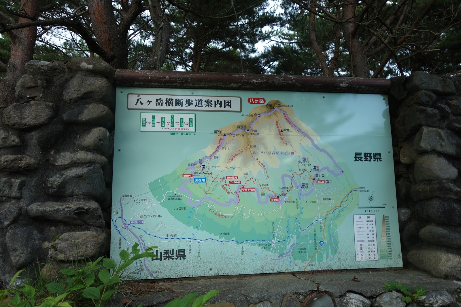
We departed from the Kan-non-daira, the starting point of mountain trail, at 1,560m. Around Kan-non-daira, it seems to be famous for the observation of a special kind of liverwort that looks green fluorescent, Hikarigoke (Schistostega pennata , ヒカリゴケ).

Note that for almost all area of mountains in Yatsugatake area belong to national park and it is prohibited to collect any kind of plants, flowers and trees. Keep rules and save a moutain environment.


Starting of a trail, it very smooth and easy to walk.


After 2.5 hours of hiking, we reached a today's first summit, Mt. Amikasa, 2,524m.


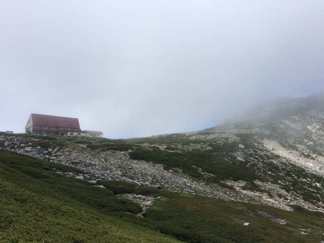
After pass through the Mt. Amikasa's summit, soon a hut can be seen. The hut is the Seinen-goya (Hut Seinen).


Many hikers had a brief break around the hut.


After we pass the hut, a rocky mountain appears in front of us, but it is not a next destination, Mt. Gongen.


We walk straight past the rocky mountain seeing a lot of alpine plant blooming .


Mt. Aka (the highest mountain in the Yatsugatake mountains) is in the cloud.


After 2hours from Mt. Amikasa, we reached the top of Mt. Gongen at 2,715m!


We headed to the Mt. Mitsugashira to make a round tour of the trekking route.


45 min from Mt. Gongen, we reached to the  Mt. Mitsugashira. We heard the roll of thunder so we walk with quick steps and go down to our car.


The round trip of this trail is not so popular and small number of hiker use it. Therefore the trail is very quiet.


Very quiet forest.


After long route of descending a mountain, we finally came back to our car. That's is not so much long course, however, it was very high humidity in the forest. It made us even more tired compared with usual. Exhaust...


We drove our car to the nearest spa and shopping place. We found blue berry ice cream!! It was very yummy for a weary body.

Michino-eki Kobuchizawa (道の駅こぶちざわ) 

After spa treatment, we discover a restaurant that looks good. Our choice was really correct. They provide a very good foods.


関連ランキング:洋食 | 小淵沢駅甲斐小泉駅


Going back to the urban....


Mount Kisokoma (Kiso-komagatake, 木曽駒ケ岳) is a 2,956m high mountain in  Kiso DistrictNagano Prefecture, Japan. The mountain belongs to the "Kiso mountains", also called "Central Alps". Hikers can take the Komagatake Ropeway and it takes you from the base of the mountain up the Senjōjiki Col, a large cirque, located at 2,650m. Before you take Komagatake Ropeway, you need to catch a bus form Suganodai Bus center or Komagane Ekimae (JR Komagane Sta.) Shirabidaira Station of the ropeway.


Access:
JR Komagane Station (駒ヶ根駅) 
Komgatatake Ropeway: https://www.chuo-alps.com/lang/en/
Access: https://www.chuo-alps.com/lang/en/getting-here/getting-onoff-the-shuttle-bus-and-paying-the-fare/
https://www.chuo-alps.com/lang/en/getting-here/getting-onoff-the-shuttle-bus-and-paying-the-fare/


From the top of the ropeway, with looking up the Senjōjiki Col, a large cirque at 2,650 m. We have already been above clouds.


Hikers and tourists use the same trail for 15 min. Then trail starts elevating towards north-west. Until reaching to the col at 2,858m, it made hikers hike up very slowly on the narrow and steep trail due to crowded by too many hikers of all ages.

We stood on the top of three mountains, Mt. Kisokoma, Mt. Naka, and Mt. Houken. Our GPS track of today's hiking is as follows.


A panorama view from the col at 2,858m.

There was a shrine at the top of Mt. Kisokoma.

A panorama view from the Nougaike (Nou pond) at 2,655m.

Amazing view from Komakai-no-ike (Komakai pond) at 2,712m. Water flow from the snowy gorge was very cool.

Note that it's very famous sightseeng place and there a lot of tourists, however, the mountains are on the 3,000m class. You need to prepare the weather changes and altitude anoxia.

See also:
https://japanhike.wordpress.com/2008/03/29/mt-kiso-komagatake/
https://www.chuo-alps.com/lang/en/experience-the-central-alps-senjojiki-cirque/senjojiki-cirque-hiking-trail/


Mount Tsubakuro (Tsubakuro-dake, 燕岳) is a 2,763 metre high mountain in Nagano Prefecture, Japan.


When we arrived at Nakabusa-onsen (Nakabusa spa, 中房温泉), thousand number of stars blighted whole over the sky!!! There was the Milky Way!!! Unfortunately, we don't have a skill to take a picture of stars and the Milky Way. It's a simple surprise that it can be seen the Milky Way from Japan, where is covered by the city lights in the night. It was because Nakabusa-onsen is located in the mountain area and far away from the nearest city.

Next morning, we started into the mountain trail at 7 o'clock, due to over slept... We knew it takes from 8 to 9 hours to make a round trip. Therefore, we thought that we should have to wake up at 5 and start 6 o'clock at least. Emmmm.... but, we seemed to be tired...

Anyway, we departed the start point of a trail up to a Mt. Tsubakuro,1462m high, Nakabusa-onsen.


Whole picture of a map and elevation graph are follows:


Approximately 2 km of walk, we arrived at one of the rest stations, Fujimi-bench, where you can see the Mt. Fuji showing its top from the cloud.


There is a mountain lodge named Kassen-goya on the middle of the trail.


Kassen-goya (Kassen Hut) is very famous for serving a cut of water melon. They sell the 1/8 cut of water melon by 700 yen. We ate this water melon on the back way to Nakabou-onsen after we reached the top of Mt. Tsubakuro, but usually, hikers eat this water melon on their way to the top for the hydration.


After leaving Kassen-goya (Kassen Hut), the trail became steep. Soon after that, Mt. Yari (Yarigatake in Japanese) suddenly appeared on our left. Mt. Yari is one of the famous and popular mountain in Japan, maybe the second famous followed by Mt. Fuji.


At 2712m, very close to the summit of Mt. Tsubakuro, there is a hut, Enzanso (Enzan Hut, 燕山荘). We haven't know that there is a dolphin like rock called "dolphin rock" around the hut


We can leave our main backpacks at the front of the hut, and we attack the summit with minimum equipments.


We pass the glass like rock called "megane (a glass in Japanese) iwa".


After 4 and half hours departed from the bottom of the trail, we reached the top of Mt. Tsubakuro. The small rock in the picture is the mark of the summit.


Ridge lines were very beautiful.


In the highland area, clustered Komakusa (English name: Dicentra peregrina) were fully blooming.


Total time of this trekking was just 8 hours and it's a regulation duration.


Way to the Nakabusa Onsen:
 Nakabusa Onsen (only available in Japanese)